IDP implements the mobile mapping technology on its projects

The IDP engineering group on its constant innovation line has implemented the use of mobile mapping technologies on all the companies civil engineering projects allowing to be more accurately and faster on the measuring and the of virtual models obtaining.
Mobile mapping is the geospatial data collection process with different cameras, scanners and others. These systems compose integrated navigation sensors which are synchronized into a mobile platform.
These platforms can be cars or other vehicles (depending on its use) that allow to register data faster than the positioning laser scanner method.
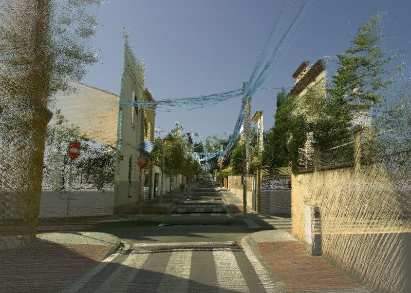
The resulting product of this works can be a point cloud with a large extension, as a city or road sectors.
This point clouds can serve as consulting models and with a data post production, inventories and measurements of the different scanned objects can be reached.
The resulting product is a point cloud of a city with all the city services integrated in 3 dimensions and with exploitation data associated so that they serve as a model to manage all this information thru an 3D interface.
IDP uses this point clouds as the base of the companies BIM (Building Information modeling) projects in engineering environments and large scale projects. An example of all this is the Sant Cugat CIM project where this technology serves as the base to models the city services for its management.

